11-7-2022
-------------
After a bit of a chilly night, I spent a leisurely couple of hours warming up in the sun at camp, making oatmeal and staring blearily into the distance as one does in the early morning.
Except, you know, it wasn’t really that early in the morning, it was more like 9. Or 10. What can I say, I’m not a morning person.
Fortunately, I can afford to dither around in the mornings on camping trips, because I simply just don’t plan too many things for the day. This is a vacation, after all, not a boot camp. Usually.
Around 10:15, I finally got my act together, piled my hiking gear into Jane, and drove all of 3 minutes up to the Chisos Basin Visitor Center just up the road.
BUT I DIDN’T GO INTO THE VISITOR CENTER
(I did stop outside of it, though, to verify the trail map I had was correct)
Instead, I opted to hop straight on the trail and get moving. The weather was perfect, the skies were blue, various birds were singing, the whole shebang. Seemed like a good time to start hiking before I got embroiled in bothering various Visitor Center staff again.
Now back when I was in Terlingua having dinner with Mary and Matt at the Starlight Theater, I asked them what their favorite Big Bend hikes were. And both said that the South Rim Trail was the best there was. They did warn me that it was a bit of a long trek – something like 12 or 14 miles round trip with over 2,800 ft of elevation gain. But no biggie, I figured I’d have no trouble at all if I tackled it early on in the trip when I still had some energy in me.
So off I headed on the Chisos Basin trails, following the
signs for the South Rim Trail via Laguna Meadows. Very fortunately, the Laguna
Meadows trail is quite pleasant, with nice little hills and a gentle uphill
incline – ideal for getting warmed up when you really haven’t been doing a
whole lot of hiking recently. And the views from the trail are increasingly
spectacular the further you go.
I climbed up through the scrubby meadows and into a more treed section of the trail. Oaks and junipers grew thickly there, shading the underbrush and sheltering all kinds of lovely fall wildflowers, and, oddly, large agaves (century plants). Living here in Texas, I’ve seen a lot of agaves, but I’ve never seen any as attractive as the ones I saw in Big Bend. Perfectly proportioned, with fat subtly patterned blue-green leaves protruding in a very satisfying symmetrical dome, these guys are real show-stoppers. I noticed that they very commonly grow right out of the base of a juniper tree, although I couldn’t tell you why. They are certainly different than the sun-loving giant agaves I’m used to seeing back at home, though.
 |
| The most pleasingly symmetrical agave I could find, for your viewing pleasure |
By this time – at, oh, about a mile and a half into the hike - the trail had turned quite steep. I slogged my way upwards, trying to remember how to breathe and feeling very out of shape. But still I pressed on, climbing higher and higher. I had things to see and places to be!
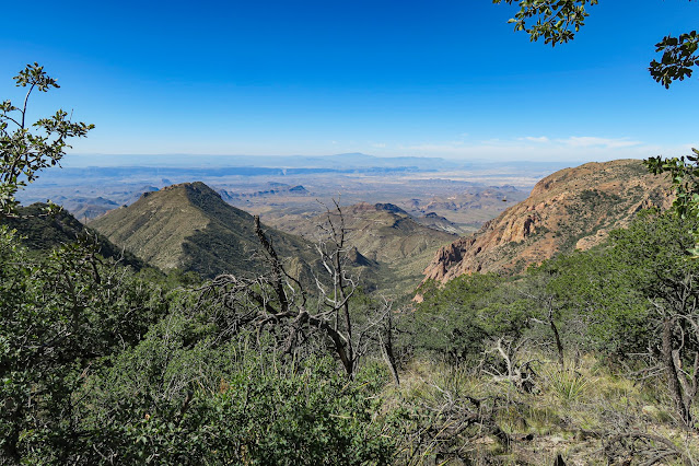
And boy, the places I had to see were getting more magnificent by the minute.
I found myself beginning to hope that I wasn’t going to have to hike through it.
A series of switchbacks took me through the remainder of the worst of the steep forested area, and I finally popped out at the top of the Chisos. It seems that a large portion of the tops have burned recently – in the past couple of years, I’d guess, based on the plants that have and haven’t popped back up. A number of the burned patches were also suspiciously close to primitive campsite locations. Hmmmmmm.
 |
| Thought the wispy, very yellow grass was neat looking though |
 |
| Remarkable |
I enjoyed a lovely meander – well, still a hike, but it felt like a meander after the rough upwards trek I had just come out of – across the tops of the mountains, heading ever southward. Because the Chisos Mountains are not actually that tall, the tops are not barren as you would see in the Rockies. Instead, they are lovely rolling grasslands dotted with trees and bushes, many of which are not encountered lower down the slopes. The mountaintops might not be that much cooler (temperature-wise) here than on the valley floor, but they are cool enough that they act as refugia for many species of plants and animals that originally colonized Texas during the last Ice Age. As the climate has warmed since then, all of the cooler-weather-loving flora and fauna have retreated to the nearest cool-ish place, which in this case is the mountaintops! And apparently that’s why you can find odd things such as a stand of quaking aspens here.
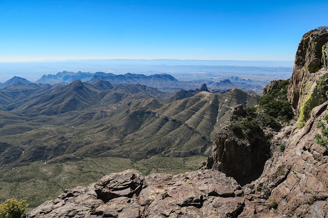
At about the 6-mile mark, I had reached the southern edge of the Chisos Mountains. The trail popped out at an overlook that was nothing short of incredible.
Talk about a view! And what a perfect place to stop for lunch. I sat and had a peanut butter sandwich and some grapes, which bolstered my spirits enough that I began to consider that maybe I should add on some more mileage to the day’s hike. If you keep skirting around the South Rim (which is ultimately a loop trail), you can dogleg off onto an even longer trail that follows the rim around to the northeast (don’t ask me at which point it goes from being South Rim to Northeast Rim… seems a bit dodgy to me).
I decided to set off and “see how I felt” by the time I got to the fork in the trail. I was keeping an eye on the clock – one minor problem with traveling in the late fall is that the days are shorter, which I definitely forgot about! Well, whatever. Whenever I say “I’ll see how I feel”, it really just means, “I’m definitely going to do it anyways even if it’s a bad idea at that point”.
So off I went. The good news is that once you reach the South Rim, the trail circles around on fairly flat land so you can at least shake the kinks out of your legs and kind of convince yourself that you have a lot of juice left in the tank.
And of course, once I hit the turnoff for the Northeast Rim (or Eastern Rim, as approximately 50% of signage called it), I decided I shouldn’t miss out.
It wasn’t a bad decision at all, though.
 |
| I see you, giant limestone cliffs that I want to climb |
I wound along the East Rim for a few miles before it took a sharp dive down into a narrow crevasse – okay, it was a totally normal creek drainage, but it felt like a crevasse after spending a couple hours at the top of the world – and finally joined back up with the South Rim Loop. Down in this little drainage, I found water for the first time all hike! Really just little pools of gross algae, but hey, I’m sure it counts for the animals that live around here. No fish, but lots of pond snails, so I’d guess it’s a seasonal creek. But it must exist for a good portion of the year, because the creekbed was crowded with a stand of large water-loving maple trees. Thus, it was there in that little drainage that I finally saw the first sign of fall: the firey scarlet and orange and golden hues of a maple!
I continued my descent back down into the forested flanks
of the Chisos Mountains, heading down the Boot Canyon/Pinnacles trail past the
Colima cut-through. Not so much to look at for a while except for trees, some
nice wildflowers and this very scary building:
 |
| Yikes |
 |
| This flower is so red that my camera struggled to take a good photo of it! Awesome |
And then the trail started winding back upwards again. I have to say that I was feeling a little sorry for myself by this point, being nearly 11 miles into the hike (counting all of the various detours to explore areas of the rim) with roughly 5 more miles to go. By now it was 3PM, and I was running a bit low on juice – and daylight! I could see the sun dropping in the sky, and wondered if I would be hiking the last bit out in the dark. Not that it would be a huge problem, as I always carry a couple lights, but also not my idea of fun!
I hoofed it up the incline, feeling vaguely distressed (or was it just my body protesting at the prolonged cardio?). But then the trail opened back up to some new spectacular views, and I kind of just forgot about being worried.
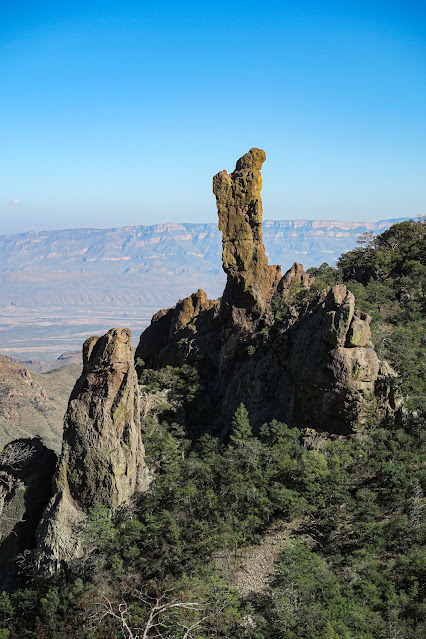
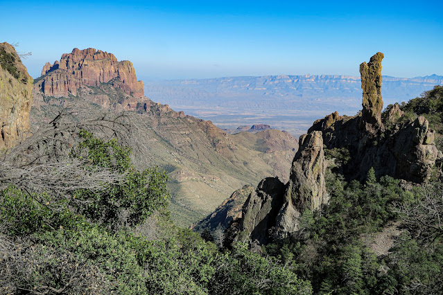
The Boot Canyon trail is very aptly named, it turns out.
 |
| Dunno man, just don't know why they would call it Boot Canyon |
 |
| No boots here |
The trail ascended to even more sweeping views of the northeastern part of the Chisos, and the world beyond. Towering knives of volcanic rock jutted up from every nearby hill and mountain, while massive limestone cliffs marched across the landscape in the background, defining the edge of the world – at least, my slice of the world for the moment.
At the turnoff for the Emory Peak trail, the path took a downward turn at last and I began my final descent. Steep switchbacks cut down through the junipers mercilessly, prompting me to half-trot my way down to avoid competing too heavily against the effects of gravity. I passed several groups of people who were headed up – presumably to watch the sunset up on Emory Peak – and thanked my lucky stars that I wasn’t them. Going down those switchbacks was not fun, and going up looked even less so!
After the switchbacks, the trail turned more moderate and I resumed a “quick stroll” kind of pace. You know, nonchalant and unconcerned but also maybe moving pretty fast just by happenstance. The shadows were growing quite long, and my dinner was calling me.
I descended past the Pinnacles themselves, and began to feel more optimistic about my arrival time. I stopped to watch some Mexican Jays eat some worms. I stopped to look at agaves. I stopped to look at neat volcanic flows. I stopped to look at great views, and okay views. I found a lot of excuses to stop.
 |
| A bit intimidating looking |
 |
| Check out the layers of entrained gravel in here! Neat |
Maybe I was getting a bit tired.
Finally, I reached the floor of the Chisos Basin again, and found myself with enough time left over to stop at a nice bench that someone had placed just off the trail at a particularly scenic overlook.
 |
| This is a very nice rock |
The sun continued to drop towards the horizon, but by that point I could see the visitor center and I knew that I was almost home free! I’d like to say that I felt a spring in my step, but I was pretty toasted. I did maybe walk a tiny bit faster, though.
And then… I reached a sign indicating that the final stretch of the Pinnacles trail back to the visitor center was closed. I would have to dog-leg around part of a different trail and get back onto the Laguna Meadows trail – the one I started on at the beginning of the day – to reach home base. Hello, unexpected extra mile of walking. Argh, the final nail in the coffin! Well, nothing to do for it but to walk, so walk I did. Fortunately this portion of the trail isn’t hilly. And I did get a chance to see the Laguna Meadows trail at a different time of day.
 |
| Compare this pic to the first pic in this post to see the importance of hiking locations at the right time of day to capture the lighting you want! |
Finally – FINALLY – I reached the visitor center again! I propped myself up on Jane and considered the day’s hike. It fell just shy of 17 miles round-trip, with about 3200’ of elevation gain. And I had completed it in 7.5 hours. Not bad for someone with a desk job! I had no doubts that I would be pretty tired tomorrow. Jane looked well-rested, at least, having sat in the parking lot being a pretty tourist photo subject all day.
Despite my griping about the length (which I did to myself, anyways) it was an awesome day, and I really loved the hike. I’d do it again in a second (although maybe not tomorrow). The views were varied and spectacular, the trail was a great mix of strenuous and pleasant, and the weather was perfect. I couldn’t have asked for a better day!
After a giant bowl of homemade pot roast with all the fixings, I rolled into bed with a contented sigh.
And that’s when the wind started.
But that’s a story for tomorrow – so until then, Kelly
signing out.


No comments:
Post a Comment