Anyone who has been to a bunch of national parks knows that they all have their own unique flavor. They're shaped, not only by the natural landscapes or places they protect, but also by those who are their stewards. Many parks could focus on a variety of different subjects, but they tend to focus their educational message on whatever their stewards think is most compelling. In the case of Dinosaur National Monument, propelled by a paleontologist, that's fossils. For Rocky Mountain National Park, that's alpine ecosystems. For Yellowstone, that's geothermal features and bison. For Capitol Reef, that's early pioneers and colonizers.
And for Colorado National Monument? Well, Colorado National Monument tastes strongly of rocks. It celebrates geology in the most wonderfully refreshing way, working to open visitors' eyes to the amazing geologic features of this area.
I realize that I'm a geologist and so probably I care more about this than most. But it bothers me endlessly when I go to a park featuring towering mountains, sheer cliffs, volcanoes, or other geologic wonders.. only to find little to no information available on the geology of the area. Ahhh! It's the worst.
So imagine my joy when I wandered into the visitor center this morning, asked about a place to learn about the geology of the area... and had the ranger respond by pulling out multiple pamphlets. He spoke with easy expertise on the formations present in the park, environments they were deposited in, ages, and even the best trails to hike to see them. Amazing!
In particular, he recommended I check out the Upper Monument Trail, which would traverse nearly all of the geologic formations available in the park. So I headed for that first to try to get it in before the heat really set in.
After a false start from the wrong trailhead - yeah, even I do that sometimes - I found myself winding down a series of steep switchbacks on my way to the canyon floor. The switchbacks provided lovely views of the canyon, in particular the "Coke Ovens", a series of really interestingly eroded rocks that look like, well, old-fashioned coke ovens.
 |
| A lovely morning at the overlook... which was not the same thing as the trailhead, apparently. |


The other reason that I wanted to get down into the canyon is because it was pretty hazy out, and I know well that taking photos looking up into the sky gives you your best chance to really make the colors pop! Sure enough, once I was at the base of the cliffs, I was looking up at an incredible view.

The rocks in this area preserve a lot of time, and a lot of interesting things that happened within that time! A lot of the Wingate Formation - the formation that makes the cliffs - preserves "fossilized" sand dune complexes and rippled sands, like these:
 |
| These ripples shows the dominant direction of flow |
 |
| Dunes form these cool bedding styles known as "cross bedding". Here you can see it really well in the lower dark unit, which was more coarse than the upper red massive unit. They eroded differently which made the bedding in the lower unit look more pronounced. |
 |
| Some more great cross beds! |
I carried on down the canyon, dropping in elevation and effectively descending through geologic time. Every corner that I turned brought new amazing outcrops with really interesting shapes and textures. Amazing!
 |
| The Wingate Sandstone (massive cross bedded cliffs) overlies the red, soft Chinle Formation (easily eroded tidal/fluvial siltstones and mudstones), making for a sharp contrast in rock types! |


As I continued on, I eventually reached the most amazing - and most underwhelming - feature in the park: a massive unconformity between the Chinle Formation (210 million years old) and the basal Black Canyon group (1.5 billion years old). The Chinle Fm sits right on top of the Black Canyon Group, meaning that the contact between the two represents a 1.2 billion year old gap in time! Essentially, anything that was deposited on top of the Black Canyon Group was eroded away in the time before the Chinle Fm came along. Amazing! But, since the Chinle is very soft and slope-forming, and the Black Canyon Group is kind of rubbly, it makes for a very unimpressive contact:
 |
| The contact is between the light reddish gray slope and the dark red slope... very cool, but also very uncool at the same time. |


The trek up the switchbacks was brutal, but as I crested the top a wonderful breeze washed over me and all was forgiven. It's amazing how a refreshing breeze can restore you!

 |
| The Book Cliffs seen in the background - amazing visibility! |

 |
| Jane at the trailhead |
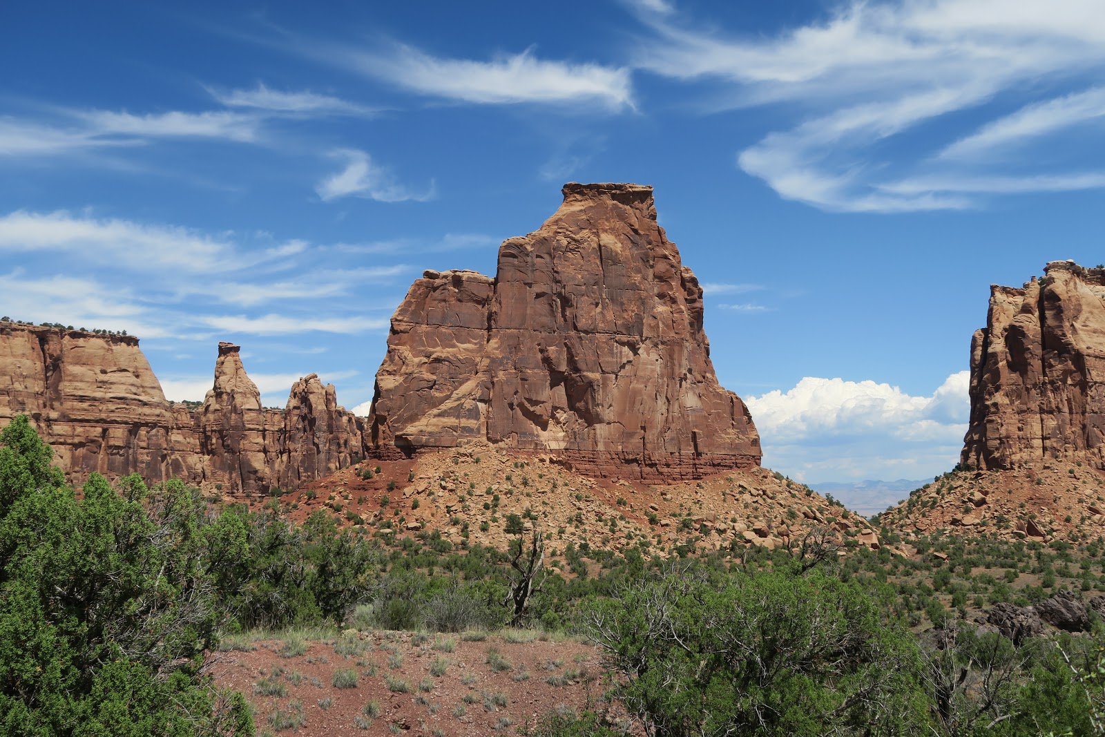
Energy revived, I then headed off to check out some more overlooks along the monument's scenic drive. Clouds rolled in in the afternoon, providing some really great lighting for a while.


 |
| Monument Rock seen from above. |


 |
| Jane with Independence Rock peeking through |


 |
| Just liked the juxtaposition of different bedding types and slightly different lithologies! Thinly bedded siltstones below, massive and cross bedded sandstones above. |
 |
| The Book Cliffs overlooking Grand Junction |

I also got to see some really cool wildlife along the way. Mostly it was lizards - my favorite was this shockingly colored collared lizard! It is hard to believe that something like this exists in the wild naturally. Amazing!


My final stop of the day was the Devil's Kitchen trail on the eastern side of the park. The clouds had thickened unfortunately, but the views were still cool.


 |
| I like the tiny tree growing out of the hole in the rock way up in the sky! |
 |
| Amazing that a tree can grow here. |


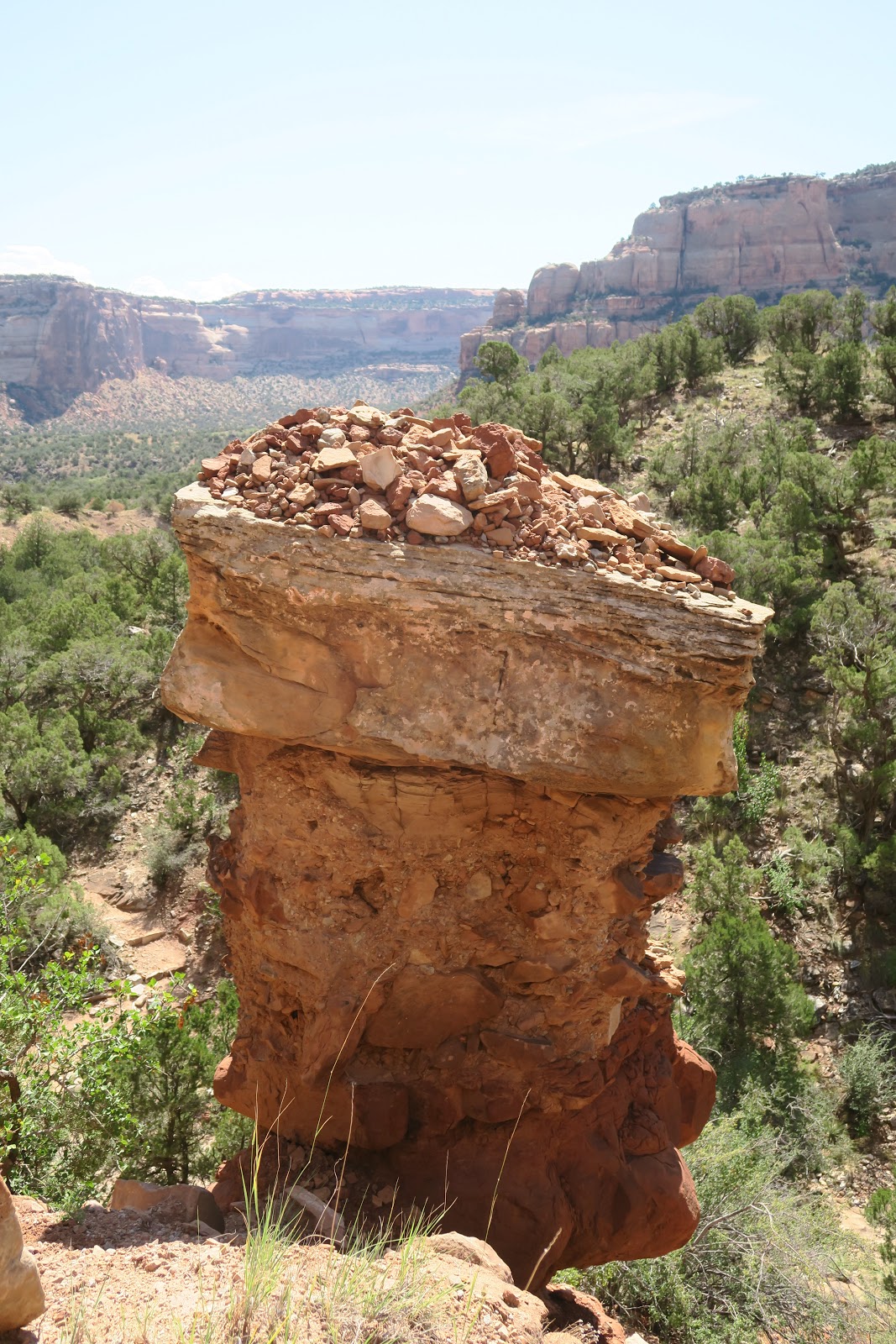
I think my favorite thing on this trail was this rocky spire, which looks like it has either a hawk or an iguana (an iguanawk??) on top of it.


 |
| (This is a different spire that kind of looks like a person) |
My plan for tomorrow was to hike Rattlesnake Arch in McInnis Canyon NCA to the north, but the weather is calling for a lot of rain and the trail is poorly marked and prone to flooding, apparently. So I think I'll leave that for some other time and revisit Colorado NM instead to do some more hiking. Until then... Kelly signing out!
No comments:
Post a Comment